What is GRASS
GRASS Mini-HOWTO by David A. HastingsHistory
- 1982: US Army Corps of Engineers, Constriction Engineering Research Laboratory (USA/CERL), Champaign, Illinois
- The GRASS Interagency Steering Committee (GIASC); The GRASS Military Steering Committee
- 1988 Award from Urban and Regional Information Systems Association (URISA) for quality software
- ~90: Open GRASS Foundation -> Open GIS Consortium
- 1992: 4.1 last CERL Version
- 1996:
USA/CERL dropps support; Commercialisation
Wants to use GRASS internally and COTS; contracts with- ESRI
- Intergraph
- Logiciels et Applications Scientifiques (L.A.S.) Inc. -> Grassland
- 1997: Baylor University ; Webpage
- 1997:
The GRASS Development Team
Baylor University, Waco, Texas, U.S.A.
University of Hannover, Germany
Promised Capabilties
4.2:- render images, 30
- Raster, 60
- Vector, 30
- Remote Sensing, 30
- Analysis
Getting it to run?
Internet
- GRASS Homepage at Baylors
- The GRASS European Homepage might even be the better resource.
Source Code
- Get it: http://www.baylor.edu/~grass/
- Compile it.
- Install helper software
- Read Documentation GDP - GRASS Documentation Project
community
- Mailinglist
- A person with a similar problem: Bill Hughes
- Giving back.
Growing some samples
GRASS is terminal, text command based. Shocking list of manpages!There is a new GUI frontend.
A typical session
Raster
Example data from the GRASS Seeds Beginners Tutorial 12km x 12km North west Leicestershire, England.Basic geographical data: from the Bartholomew 1:250000 digital map data
image: standard Landsat Thematic Mapper (TM) Band 4, captured 8th July 1984
DEM/Contour data: digitised manually from a 1:50000 scale paper map source

Vector
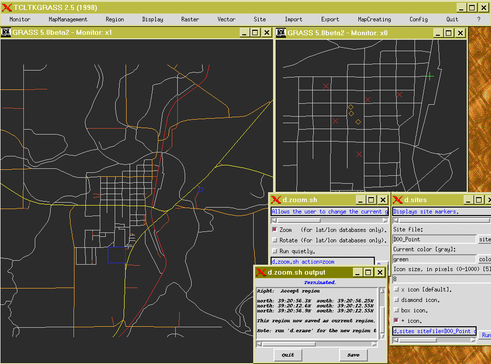
TIGER Census Data. Extracted by Bill Hughes. (Jefferson County?)
Vector/Sites

Fancy
d.3d

Moving Fun
Free Software is Important for Science & Education
- Comprehensible/Transparent
- The turnback is faster
- Support: Your Time <--vs--> Your money
- Everybody can recreate the results -> Falsification
- Give it to students
- Us it as long as you want
Conclusion
- Real test still missing
- GRASS will get better, but will remain dragon!
- Advantages: Powerful, shell scripting
- Disadvantages: Takes longer to make "nice" maps; harder to learn for people who never used command line applications
- GRASS is an Alternative!
Future?
- Still have to do the final map!
- Discovering more about GRASS
- GRASS on the UWM alphas?
 Borrowed from
Tom Polakin's Webpage
archived: December 2003 - page revision: Tue May 18 17:48:35 CDT 1999 Part of Bernhard Reiter's archive.
[ Archived: Bernhard's UWM Homepage ]
![[GRASS Banner]](gbanner.jpg)