Application Development: WebGIS
The topic of digital maps in networks ranges from simple solutions to visualize spatial data (WebMapping) upto special applications with browser-based data manipulation and data management.
Our solutions are standards compliant and vendor-independent. Spatial data infrastructures (SDI) are usually the basis for special applications. We do implement all three tiers: Database, SDI services and application.
Special Topic Secured SDI Services: Based on the broad security know how from the the other business areas of Intevation we offer consulting and implementation for securind services WMS, WFS-(T), etc. We currently realize this for the german states Lower Saxonia and Bremen. We emphasize efficient concepts: not highly complex but rather well-sized.
Sample References
Development of Agrar- und Umweltatlas (AGRUA)

The federal agency of nature and environment (Landesamt für Natur und Umwelt) in Schleswig-Holstein as well as its project partners have assigned Intevation GmbH for continuing the development of the AGRUA-project. Within this project lots of improvments and new implementations were made, e.g. numberbased search, extended OGC-capabilties and self-registering for users. Furthermore installations for the partners Mecklenburg-Vorpommern and Rheinland-Pfalz were made. More ...
Installation package of BKG GeoWebServer

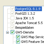
The Federal Agency of Cartography and Geodesy has assigned Intevation GmbH and its partner lat/lon GmbH to create an easy-to-install GeoWebServer for creating nodes for Geospatial data infrastructures (GDI). The deegree-framework and the database PostgreSQL/PostGIS are forming a powerfull backend for the GeoWebServer. Intevation has developed an installer for Windows and GNU/Linux. This focuses the easy installation of a working GDI-node with only a few mouse-clicks. More ...
WebGIS for federal association for waste management

The german federal association for waste management (BDE) provides a webbased application for its members. It enables them to search for members and facilities by various criteria and to visualise the search results on an interactive map. You can also click on facilities on the map to get detailed information about the site. The application is publically availble on the BDE web-site. More ...
Drilling data in Federal State Office of Mecklenburg-Vorpommern

The State Office for Environment, Conservation and Geology in the Federal State Mecklenburg Vorpommern (LUNG-MV) has various drilling profiles as well as additional geodata that are relevant for groundwater issues. Those geodata should be made avaible for a larger audiance within the department without the need to buy or to learn a new complex software. More ...
Historical points of interests in northern Germany: Webbased Informationssystem and Digitizing

The association "Die Schaumburger Landschaft" maintains the project "Spurensuche" (trace search). This project aims to gather treasures as witnesses for culture and historical landuse (so called traces). Lots of honorary contributors are working to collect and document those traces. More ...
Geodata server of district government Hannover

The district government (Bezirksregierung) of Hannover, Basson-Saxony, offered a geodata-server which gives the possibility to visualize geodata of the GIS-office in a web-browser. The applications on the server have been developed by the GIS office of the district government in cooperation with Intevation. As of January 1st 2005 the district governments of lower saxonia have been closed. The geodata-server remains in service. More ...
Standard-compliant system for web-based digitisation

GIS structures in public administrations have been developed in a heterogenous way over many years. Different structures and data formats in various departments, local authorities etc. make it difficult to exchange and network the geodata. This has been the background for this project implemented on behalf of the district governments of Lower Saxony. An intermediate layer with interfaces based on the standards of the OpenGIS Consortium (OGC) realises an unified access on the hetergenous data sources for further applications. More ...
MapIt! - Rastermaps in Web Applications

MapIt! is a simple web application to visualize raster maps and emphasize selected objects of interest on these maps. More ...
 Sitemap
 Deutsch